Box Hill is a summit of the North Downs within the Surrey Hills National Landscape, named for the ancient box woodland on its chalk slopes above the River Mole. The National Trust manages it, and there is no entry fee. The countryside is open from dawn to dusk. Leopold Salomons, a London financier, gave 230 acres to the Trust in 1914, and the Salomons Memorial Viewpoint was dedicated by his wife in 1920. The Trust calls it the best-known spot on the hill, visited by nearly a million people a year.
The stepping stones circular
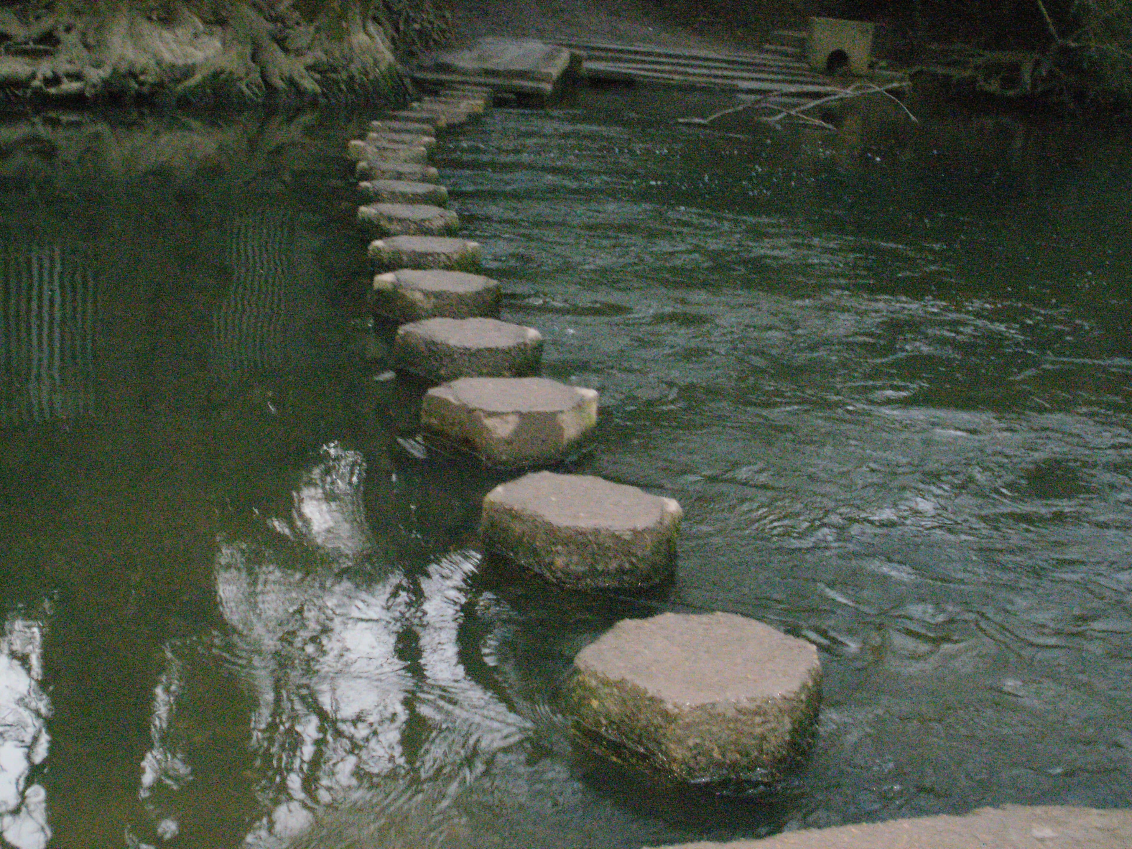
If you only do one walk, make it this one. The National Trust's Stepping Stones walk is 2 miles (3.2km), gives 1 hour 30 minutes and allows dogs. It starts at the summit and drops to the River Mole, so the steepest work comes on the way back. The Trust counts 275 steps on the descent.
You follow the surfaced path beside the road, then take the left fork down to the river. Cross on the stones or take the riverside path, then go through Burford Meadow. Opposite are the wooded chalk cliffs known as the Whites. At the far end of the meadow, take the path left of the road bridge up to the A24, turn right over the river and pass Burford Bridge Hotel. Take the right-hand path after the hotel and climb past the old fort to the visitor centre.
Wear walking boots or sturdy shoes, as paths can be slippery when wet. The stepping stones can be impassable when the river is high, so check conditions after heavy rain.
Up from Burford Bridge
From the foot of the hill on the A24, take the right-hand path immediately after Burford Bridge Hotel. At the fork, keep to the left grassy track and head straight uphill. The National Trust calls it a steep climb, with wild flowers and butterflies in spring and summer.
Up from Westhumble
The train to Stepping Stones walk starts at Box Hill & Westhumble station and runs 3 miles (4.8km) in about 2 hours, with dogs welcome. You walk through the station car park, turn right at the road and pass the Stepping Stones pub. Then it goes through the underpass beneath the A24, over the river bridge and round by Burford Bridge Hotel before the climb to the summit. It passes Salomons Memorial and returns to the station. There are toilets and a National Trust café at the top, and a separate café at the station.
The Walking Club has a longer option from the same station: Box Hill to Leatherhead, climbing Chapel Lane, crossing the Mole on the stones and descending via Juniper Top. It describes it as short but hilly, with views.
Other loops from the summit
Hilltop stroll: a gentle 1 mile (1.6km) circular.
Happy Valley: 2.7 miles (4.32km), taking in Broadwood's Tower and Salomons Memorial Viewpoint.
Juniper Top: 4 miles (6.4km), with steep sections and views as far as the South Downs. Stout boots are recommended, and it is especially lovely when the bluebells are out.
Box Hill Hike: a challenging 8 miles (12.8km) circular with pub stops.
The Zig Zag Road
The Zig Zag Road is climbed from the Old London Road by Burford Bridge Hotel. Take the first right on to the Zig Zag Road for about 1.6 miles (2.5km) to the summit. The National Trust calls it one of the world's most popular hill climbs, with the café and the view as the reward. It featured in the 2012 Olympic road race, which climbed it nine times for the men and twice for the women, and Wikipedia gives an estimated 15,000 spectators for the men's race. Cyclists have been coming since the 1880s.
The road is narrow with tight hairpin bends, so it is not suitable for large vehicles. Coaches should approach from Box Hill village to the east.
Parking and getting there
The summit car park (sat-nav: The Old Fort, Box Hill Road, Tadworth, KT20 7LB) charges £2 for up to an hour, £4 up to two hours, £6 up to four hours and £9 all day. National Trust members park free. There is no phone signal, so set up the JustPark app before you arrive, or use a machine. On the Burford Bridge side, walkers are directed to the small Stepping Stones car park, turning right about 350m along the A24 approach. Check the tariff on site. There is no overnight parking or camping, and no fires or barbecues.
The nearest station is Box Hill & Westhumble, 1 mile (1.6km) from the summit by a steep uphill walk. It is on the London to Dorking line. Arriva's 465 bus runs daily between Dorking and Kingston, with stops at the bottom of the hill, including for the Zig Zag Road and the stepping stones. Cyclists can use the path beside the A24 from Dorking, about 3 miles (5km).
National Trust facilities
The café by the main car park serves barista-style coffee, cakes and hot lunches, with 25p off if you bring your own cup, and has high chairs. It is open 10:00 to 17:00 until 31 October, then closes at 16:00 from 1 November. The servery opens earlier, and toilets, including an accessible one without a hoist, are next to the café. There is cycle parking for 15 bikes. A pre-loved bookshop next to the servery opens Saturday to Thursday, subject to volunteers. Visitor facilities have closed in high winds before, so check the National Trust's Box Hill page before you travel.
Where to eat after
Box Hill café, summit, Box Hill Road. The obvious first stop for coffee, cake or a hot lunch, and the easy choice at the top.
The Stepping Stones, Westhumble Street, Westhumble. A country pub passed on the station walk. Muddy Stilettos describes a terrace in summer and fires in winter, and a hearty menu perfect after a romp on Box Hill. It is the natural end to the Westhumble route, with muddy boots and dogs welcome in the bar area according to its Tripadvisor listing.