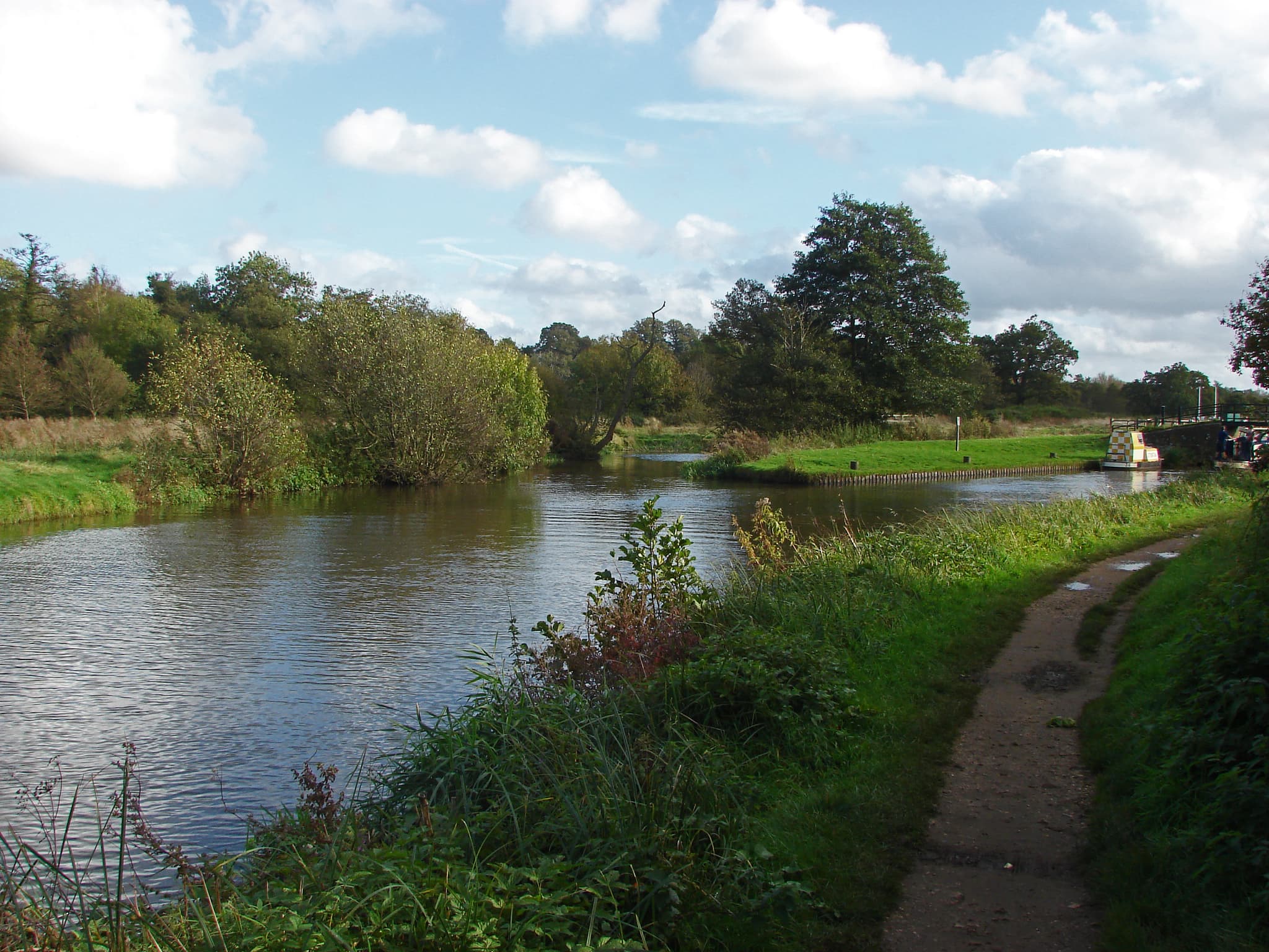
The River Wey is one of the oldest navigable rivers in the country, and its towpath is among the easiest long walks in Surrey. It is flat, wide and mostly shaded, and it passes through some of the county's most varied scenery without ever asking much of your legs. The National Trust looks after it, and describes about 20 miles of towpath open to walkers.
How the waterway fits together
The Wey Navigation runs from the Thames junction at Shepperton to Guildford. The Godalming Navigation carries on from Guildford to a terminus at Godalming. Waterways sources give the navigable Wey as 15.3 miles and the Godalming section as 4.2 miles, with four locks. Wikipedia puts the combined length at 19.5 miles, which makes a continuous route from near Weybridge via Guildford to Godalming.
The history is worth carrying in your head as you walk. Sir Richard Weston made the first improvements on his own land between 1618 and 1620, and the river opened to barge traffic in 1653. The extension to Godalming was completed in 1764. The Stevens family ran the navigations for over a century before they passed to the National Trust in the 1960s. The last cargo of timber left Godalming Wharf in 1925.
The walk we would choose: Guildford to Godalming
For a half day, walk upstream from Guildford to Godalming along the Godalming Navigation. AllTrails gives the route as 8.9km between the two railway stations, easy and mostly flat, at two and a half to three hours. She Walks in England measures it at 5.7 miles. Both stations are on the same line, so you can walk one way and take the train back.
The path is wide and earthy, with a mix of tree cover and open stretches. Expect mud in places. You pass St Catherine's Lock, where the difference in water level is easy to see, and go under a railway bridge. Steps lead up to a Second World War pillbox. The National Trust notes that the stretch under St Catherine's Hill gives a glimpse of the golden sands that gave Guildford its name.
The four locks on the Godalming Navigation are Millmead, St Catherine's, Unstead and Catteshall. Catteshall Lock, at Farncombe in Godalming, is the southernmost on the whole system. Near Shalford the navigation meets the entrance to the Wey and Arun Canal at Stonebridge Wharf, once called Gunpowder Wharf because powder from the Chilworth mills was transferred there. Godalming Wharf, the upper limit, stops about 50 metres short of the town bridge.
Before you set out, check the National Trust page for the towpath. AllTrails notes that part of the route near Guildford was temporarily inaccessible from July 2026, with a Surrey County Council footpath notice attached, so look for the latest position.
Dapdune Wharf, Guildford
Dapdune Wharf, on Wharf Road in Guildford (GU1 4RR), is the place to understand what the river was for. It is four acres in the middle of the town and the historic home of the Wey barges that worked from Guildford to the Port of London. The Stevens family began building their own barges here from 1840.
Two of the three surviving Wey barges are here. Reliance sits in a dry dock that visitors can board, and Perseverance IV is afloat and awaiting restoration. There is also a smithy and stables, a tearoom with seating overlooking the water, a book shed and a play area, which makes it a good stop with children.
Boat trips leave from the wharf. The National Trust lists £9.50 for an adult and £5.50 for a child (aged 1 to 16), or £75 to book the whole boat. Visit Surrey says trips take about 40 minutes, run Thursday to Monday in the open season and cannot go ahead when the river is in flood. The Dapdune Belle takes a maximum of 12 passengers plus the skipper.
Opening days matter if you are planning around a weekday. The National Trust's listed hours show Thursday to Monday, 11am to 5pm, so check before you go on a Tuesday or Wednesday. The car park costs £5.50 for up to four hours or £8.50 all day for non-members, and is free to members. The wharf phone number is 01483 561389.
Two pubs on the water
The Guildford to Godalming stretch is light on pubs by the towpath, so plan to eat in either town at the end. For a pub, two are worth knowing on other parts of the navigation.
Ye Olde Ship Inn, Guildford
On Portsmouth Road in Guildford (GU2 4EB), reached from the towpath by the Ferry Lane footbridge just north of Dapdune. CAMRA records a pub on the site since 1556, with a garden, an open fire and wood-burner, boating memorabilia and three regular beers. Canal Boat magazine says pizza is a speciality, and the wood-fired oven is the thing to order. It suits a stop at the end of a Dapdune visit. Phone ahead for hours.
The Anchor, Pyrford Lock
The Anchor sits beside Pyrford Lock and bridge (GU23 6QW), about eight miles from Guildford by water, so it is the reward on a longer walk or the start of a Weybridge-bound one. Hall & Woodhouse describes a terrace along the canal, log fires and an oak-beamed conservatory. CAMRA notes two regular Hall & Woodhouse ales and a changing guest, and says the food is a focus and the pub busy in summer. It is handy for RHS Wisley, too.
Longer options
Godalming to Weybridge: GPS Routes measures the full length at 19.9 miles, passing Guildford, Sutton Place, Pyrford and Byfleet and finishing at Weybridge, where the Thames Path begins.
Weybridge to New Haw Lock: the National Trust lists a 5 mile walk following the route of the last commercial barges.
A circular in Guildford: the Ramblers' route is 4.2 miles and takes about 2 hours 10 minutes, starting from Farnham Road Car Park (GU2 7NP).
Guided walks: the National Trust runs free guided walks led by River Wey volunteers, varying in length.
Wear shoes you do not mind getting muddy, and look at the Environment Agency flood page before setting out after heavy rain. The Wey is dog-friendly according to the National Trust, which gives the property two pawprints.
Details and walking information are on the National Trust page for the navigations, and the Canal & River Trust-style waterways guide has the history. For the Anchor see Hall & Woodhouse, and for the Ship the CAMRA listing.